
Visit to Banco Chinchorro from Costa Maya Mahahual
Conocida como el grupo de coral más grande del hemisferio norte, Banco Chinchorro, está a 35 km en barco de la costa de Mahahual. Esta área natural está protegida desde 1996 y es el hogar de una gran cantidad de peces
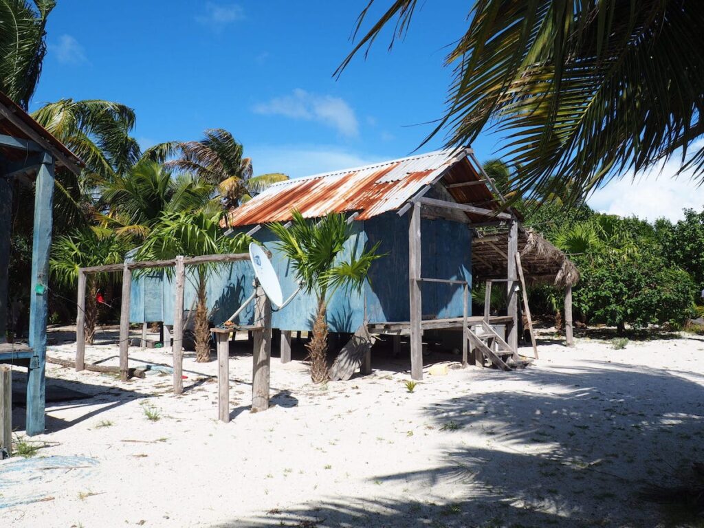
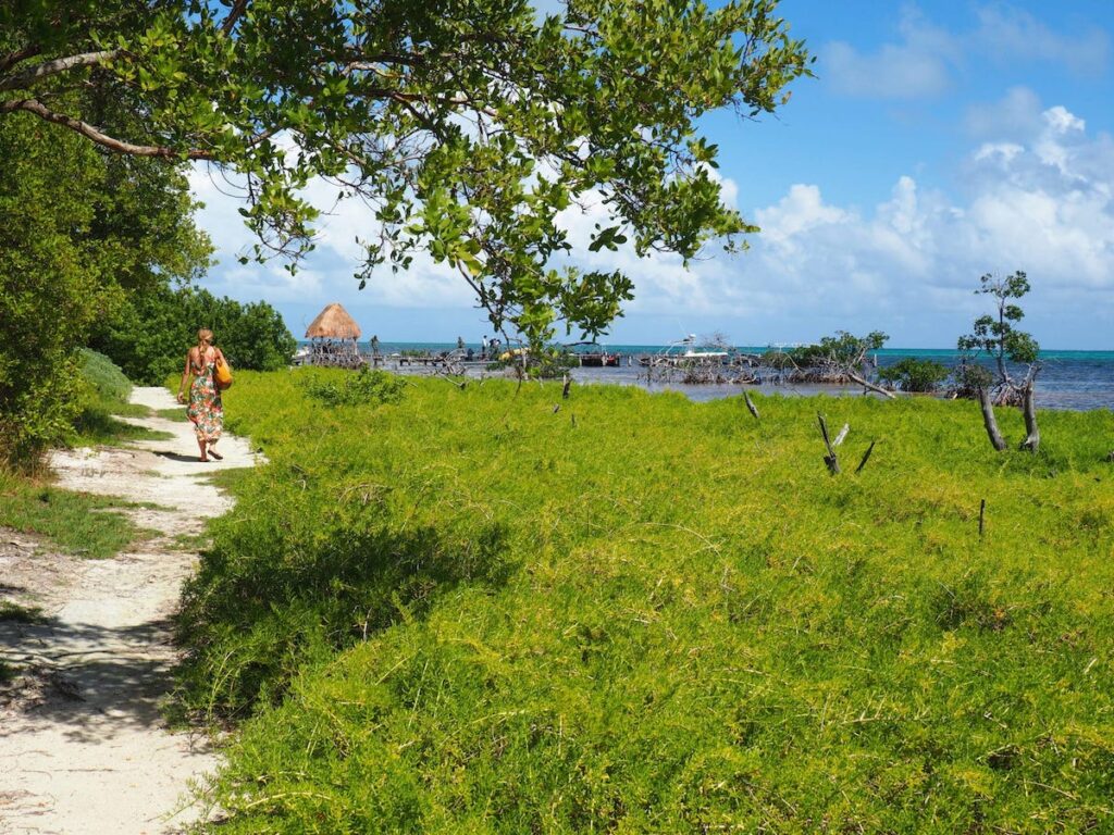
Although the Yucatan peninsula has been immensely popular for decades, it is still possible to find some less visited places in the area, mainly in the southern part of the state of Quintana Roo. I think the rule is that the further you get from Cancun, Playa del Carmen and Tulum the smaller and less touristy towns become. Mahahual is one of these places, a hidden gem in the south of the state.
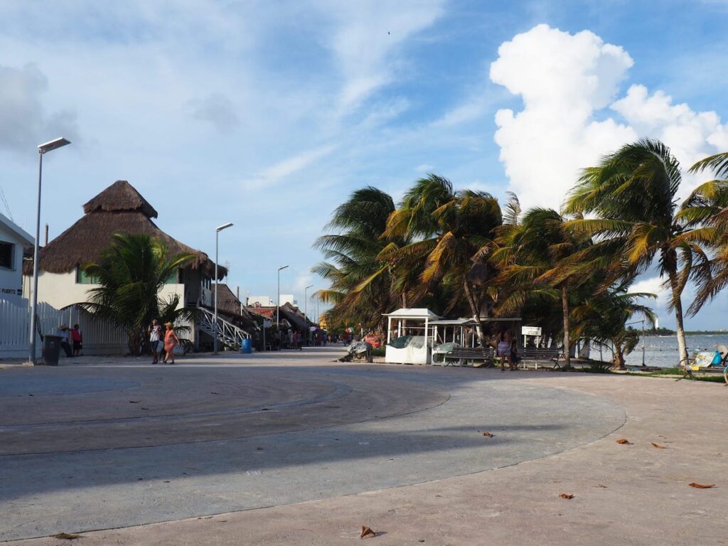
This small fishing village is located halfway off the main Cancun – Chetumal highway. But you have to take a detour from the highway and drive for another 50 minutes through a straight, swampy road before reaching the village.
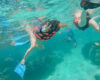
Apart from walking along the boulevard with its seafood restaurants and handicraft shops, there are many activities to enjoy in Mahahual. But there is one main reason why people from various parts of Mexico and the world come here; the town is a popular destination for lovers of marine life.
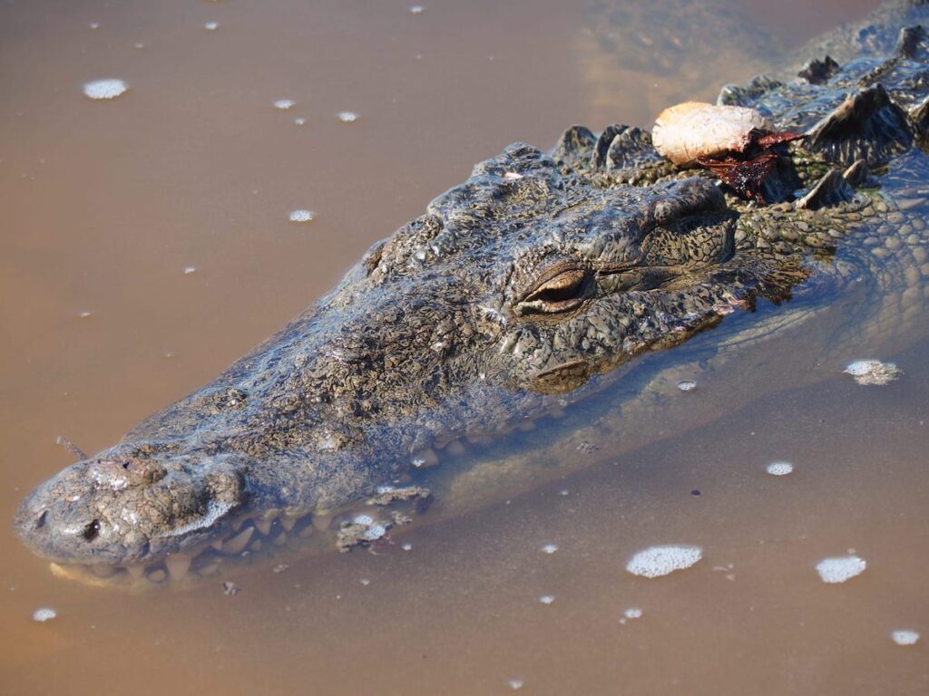
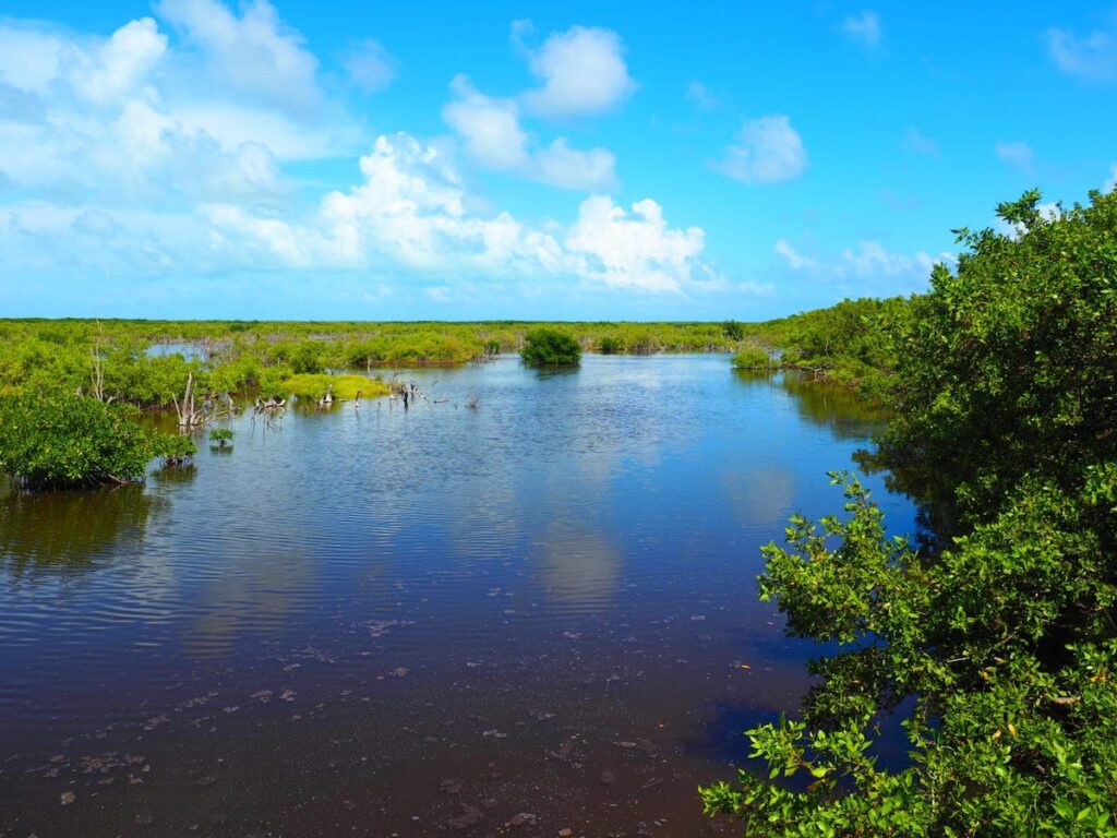
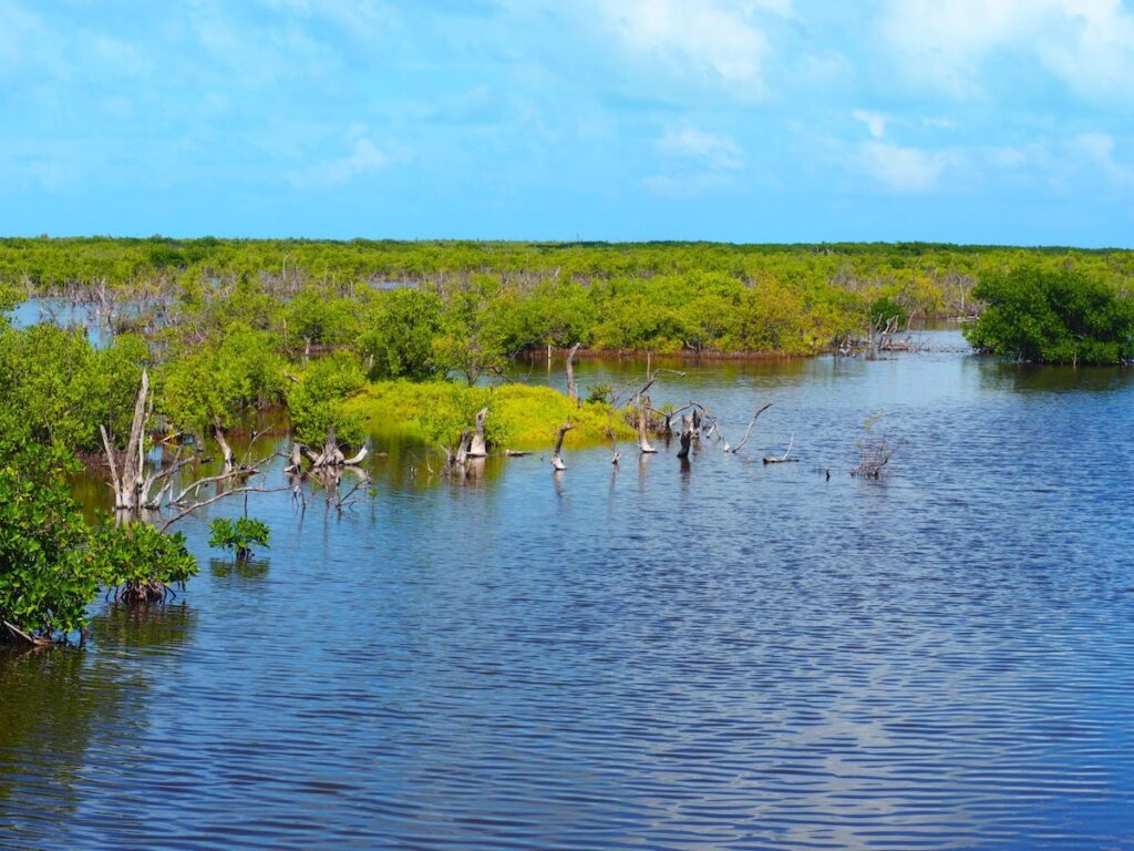
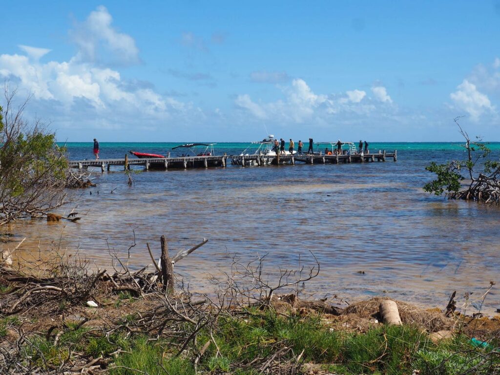
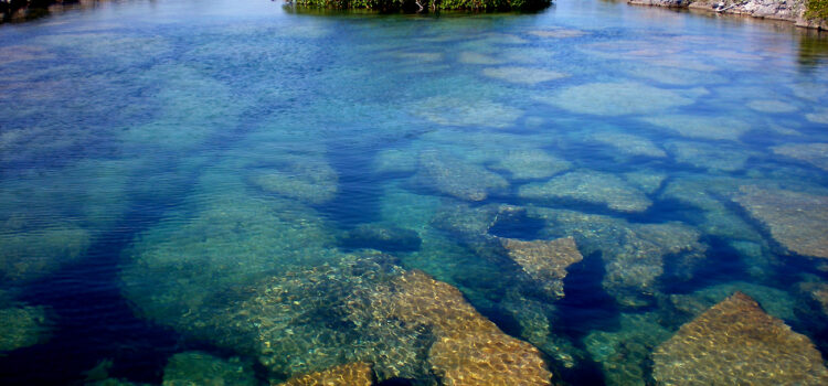
Known as the largest coral group in the northern hemisphere, Banco Chinchorro, is 35 km by boat from the coast of Mahahual. This natural area has been protected since 1996 and is home to an abundance of fish (also large as nurse sharks, spotted eagle rays, and even the occasional hammerhead shark), large coral reefs, and several shipwrecks, including two Spanish galleons. There is even a place where the shallow bottom is dotted with ancient canyons.
I have heard from many people that some tourists tend to (touch animals / throw garbage in the ocean), but thankfully we did not experience this at all on this trip. In fact, the guides actually noticed that no one entered the water with chemical sunscreen and I saw one of them even jumping into the water when someone accidentally dropped a tissue from the dock.
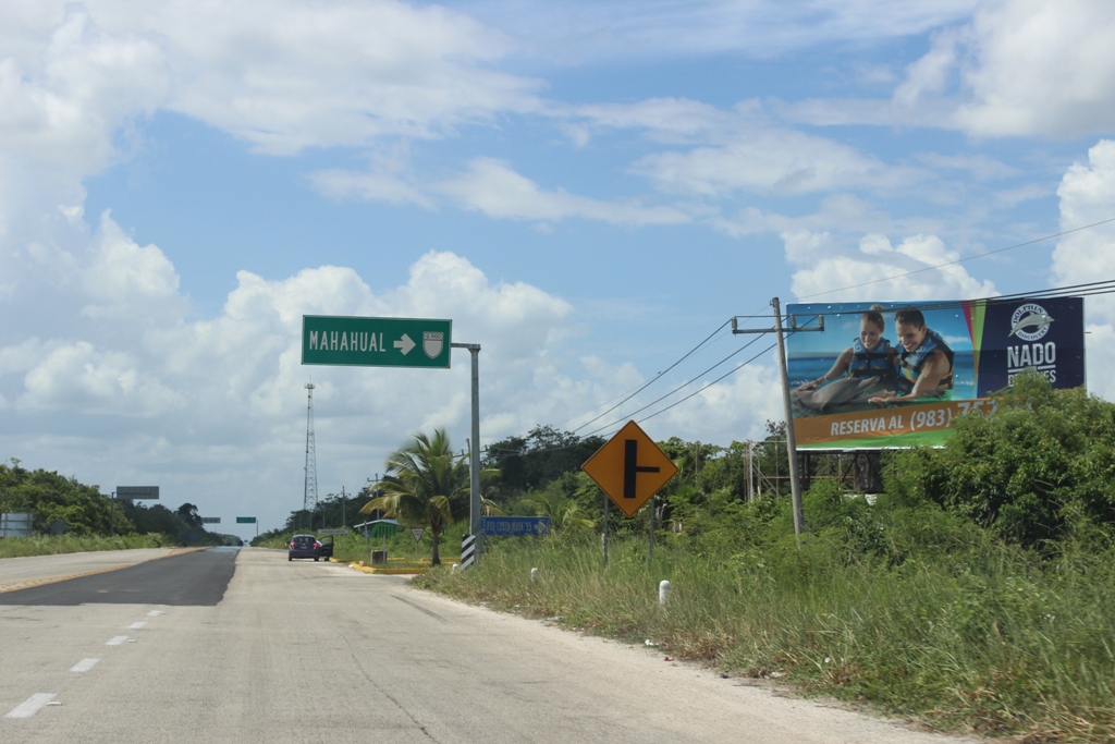
After snorkeling, it was a short boat ride to the island of Banco Chinchorro. Aside from a couple of lobster fishermen, the area is deserted, which means there is plenty of room for wildlife.
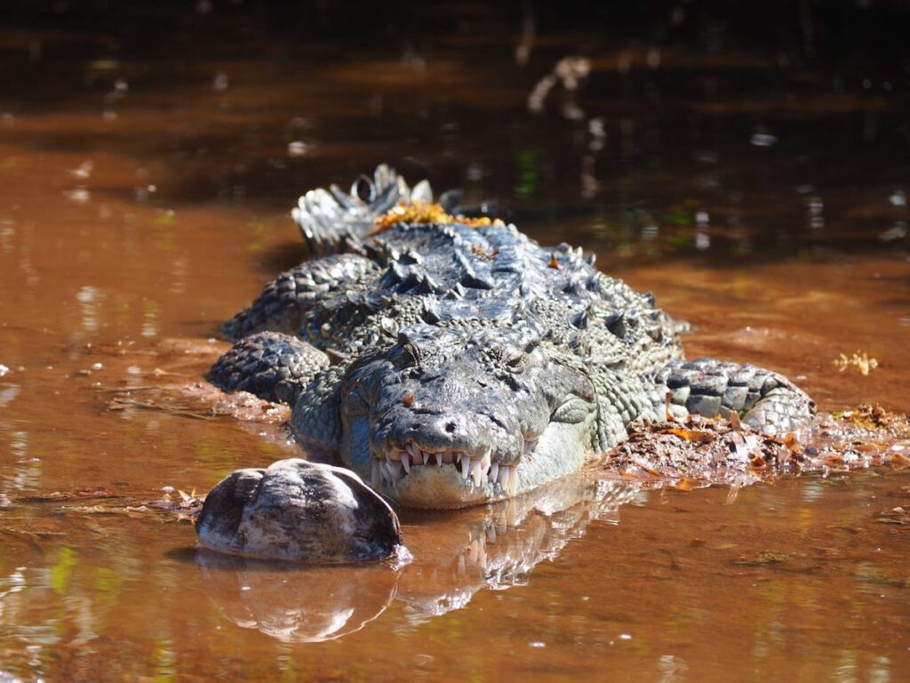
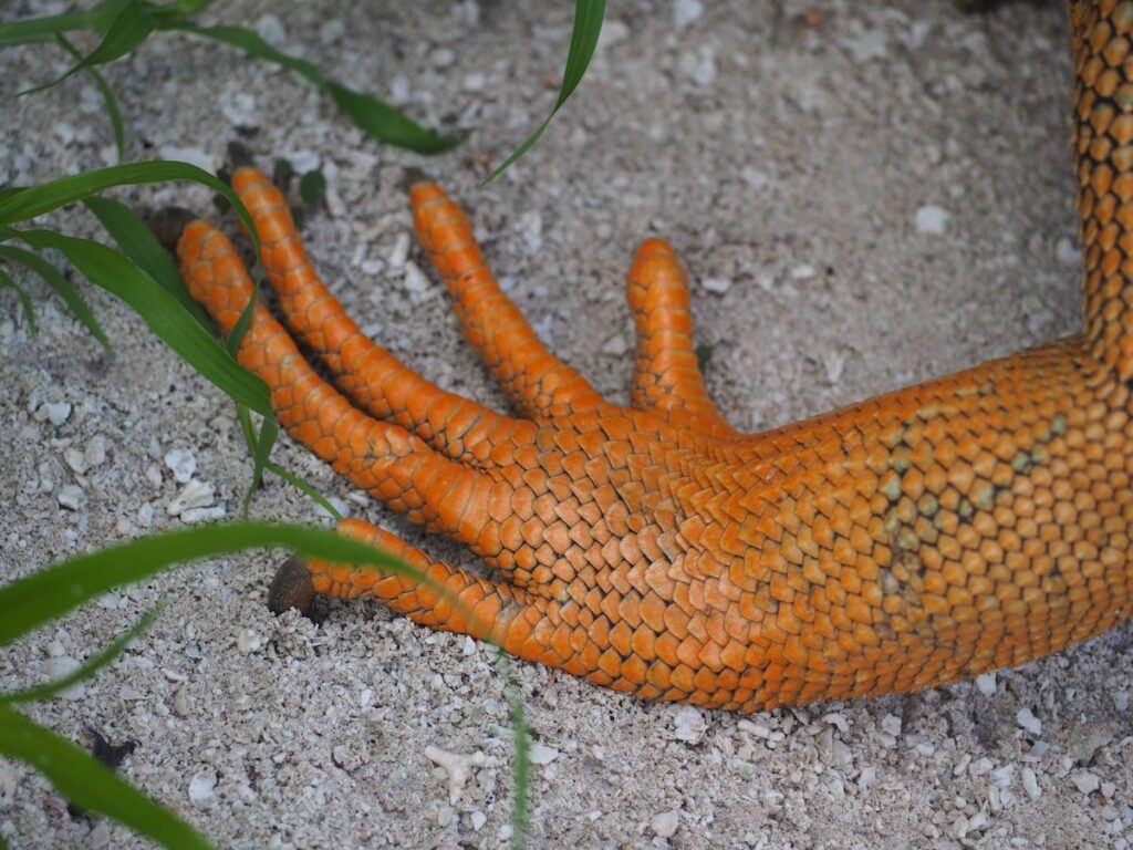
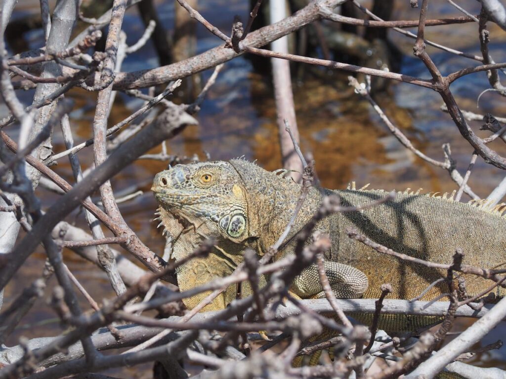
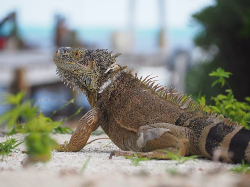
The natural vegetation of the Banco Chincorro Islands is mainly mangroves and the area is densely populated with iguanas and crocodiles.
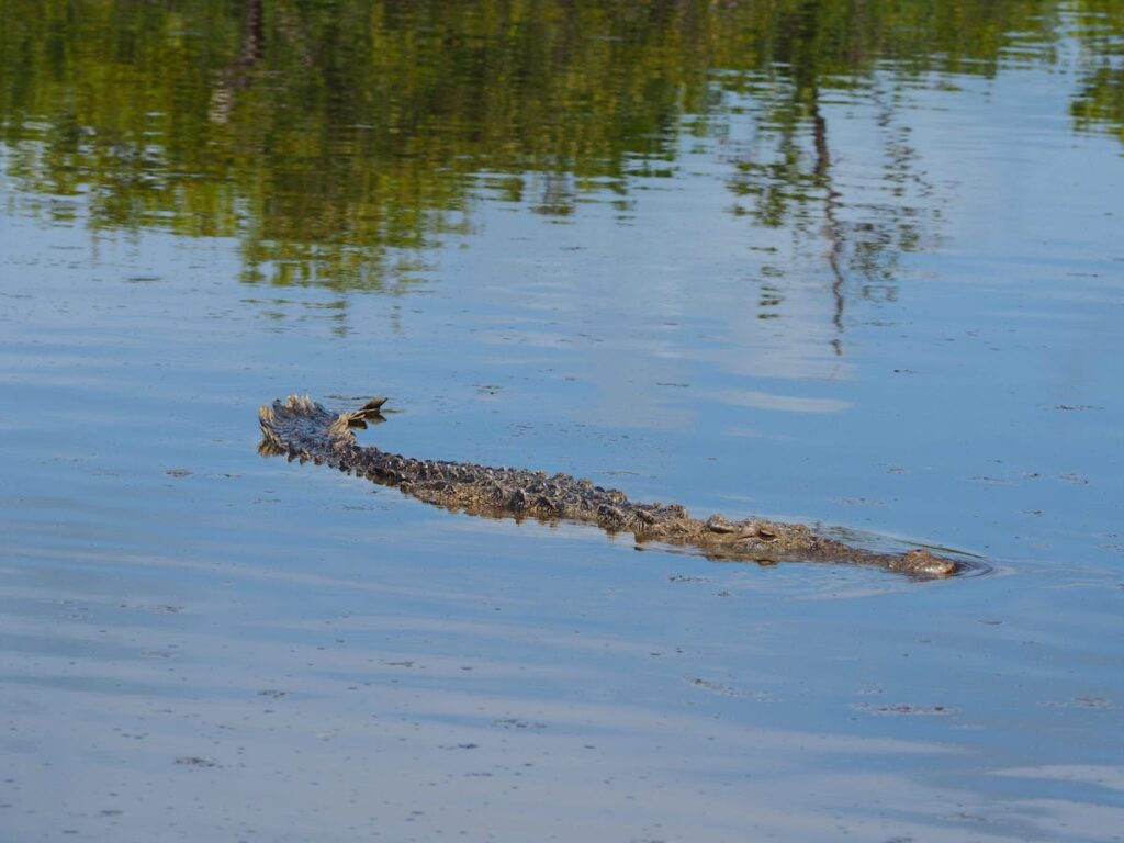
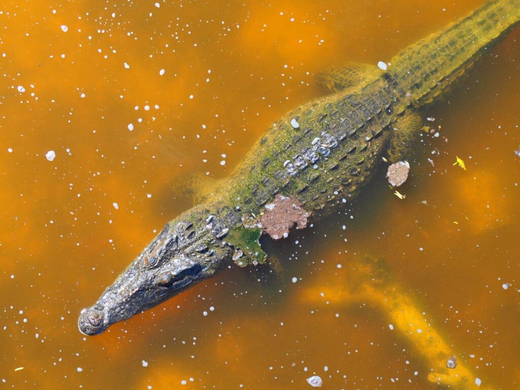
This is an unprecedented prehistoric show!
Unfortunately, none of the guides had ever told us about these creatures at first and when we were looking for a bath, we were quite close to the crocodiles without even knowing it! They literally pop out of the bushes when you walk. That would have been a terrifying experience while urinating …
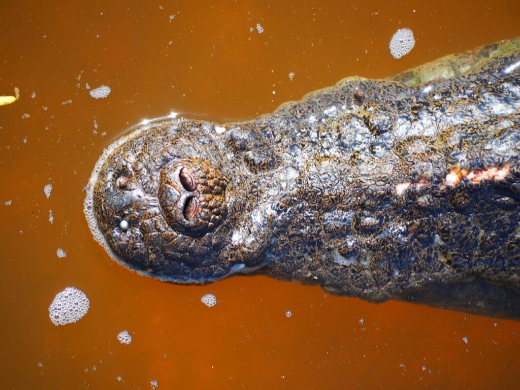
On the other side of the island there is a small wooden platform, from where you can closely observe the crocodiles, which is very incredible. The crocodiles seem hungry as many of them approached our deck once the guide threw a piece of wood into the water.
This is where Banco Chinchorro is located in Mexico:
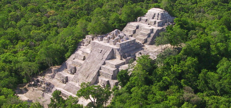
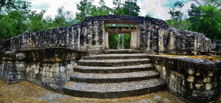
Archeological site Calakmul
It was one of the largest important cities in the region. It establishes a matchless socio-political network of links. After the year 695 AD. C. Due to his defeat at the hands of Tikal he had a political reorientation towards the north,
It was one of the largest major cities in the region. It establishes an unparalleled sociopolitical network. After the year 695 d. C. Due to its defeat at the hands of Tikal it had a political reorientation toward the north, where the new rulers established relations with other sites of the area known as River Bec. In spite of the diminution of its political power, the city experienced urban growth, since most of the vestiges that today are observed correspond to this period.
Calakmul is the most important area of Campeche, if you would like to know everything about the enigma that surrounds Calakmul we recommend hiring the service of a specialized guide.
- There are two payments, access to the archaeological zone of 70 MXN and to the Calakmul Biosphere Reserve, which you pay per vehicle MXN 56 and MXN 50 per person.
- The access entrance to the Biosphere Reserve, which is in Conhuás, open at 6 in the morning. Sundays are free for the national and residents with official identification.
- They do not sell drinks or food inside. There are services at the entrance.
- There is no public transport until the archaeological zone. The options are taxi, agency or private vehicle. To Xpuhil there is public transportation from Escárcega (2 hours), Chetumal (1 hour 40 minutes) and Campeche (4 hours 30 minutes). Conhuas arrives collectively from Xpuhil.
- It is recommended to bring light and light clothing, hat, insect repellent, sunscreen, closed shoes (you are in the jungle and there are many bugs, protect yourself), water and something to eat if ideas spend the whole day.
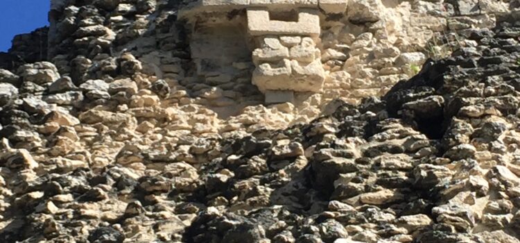
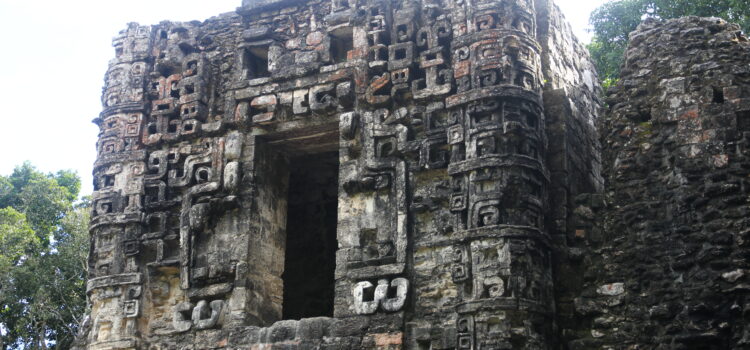
Zona arqueologica Becán
Discover the “snake path”
It is located in the middle of the base of the Yucatecan peninsula, in the south of Campeche and the archaeological region of Rio Bec. The architecture is characterized by palaces of several rooms wide interior benches, with tall towers and narrow all sides. The towers have impractical stairs and false temples at the top; Symbolize sacred mountains. The facades usually show large zoomorphic masks or squared panels and symbolic vegetal motifs or waterfalls of stylized masks.
If you would like to know everything about Becán and its relation with Calakmul and the other archaeological zones we recommend to hire the service of a guide specialized in the subject.
- Becán is located 8 km from here of the town of Xpuhil, on the 186 Chetumal-Escárcega Federal Highway.
- Sundays are free for the national and residents with official identification.
- Entry fee 47 MXN.
- They do not sell drinks or food inside. There are services at the entrance.
- How to get there by public transport? To Xpuhil there is public transportation from Escárcega (2 hours), Chetumal (1 hour 40 minutes) and Campeche (4 hours 30 minutes).
- Wear light and light clothing, hat, insect repellent, sunscreen, closed shoes better to climb the pyramids and some water is always going well.
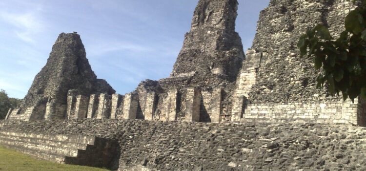
Zona arqueologica Xpujil
The enigmatic “cat tail”
The area of the pre-Hispanic site of Xpuhil that is open to the public and in the custody of INAH is only an architectural group known as group one which is constituted by some of the many buildings that are part of the archaeological zone. In fact, to date has been reported about 25 architectural groups on a total area of land comprises an area of about 24 km ². As the current population of Xpuhil, head of the municipality of Calakmul, is located in the same place as many of the ancient pre-Columbian Maya community, it is evident that many mounds are affected on the surface of the site.
If you would like to know everything about Xpujil and its relation with Calakmul and the other archaeological zones we recommend to hire the service of a specialized guide in the subject.
- Xpuhil is located a few meters from the town of Xpuhil, on Federal Highway 186, at the exit west direction Escárcega.
- Sundays are free for the national and residents with official identification.
- Cost of entry: 47 MXN.
- They do not sell drinks or food inside. There are services at the entrance.
- How to get there by public transport? To Xpuhil there is public transportation from Escárcega (2 hours), Chetumal (1 hour 40 minutes) and Campeche (4 hours 30 minutes).
- It is recommended Light and light clothing, hat, insect repellent, sunscreen, closed shoes better and some water is always going well.
Zona arqueológica Hormiguero
Nestled in the heart of the southern jungle of the state of Campeche, the anteater site is made up of about a hundred pre-Hispanic structures. It was registered in 1933 and was named after the large number of “ant houses” found. Three large architectural groups are defined, of which, The so-called center has been the area where archaeological interventions have been carried out since the decade of the 70’s of last century.
If you would like to know everything about anthill and its relationship with Calakmul and the other archaeological zones we recommend to hire the service of a guide specialized in the subject.
- Hormiguero is located 23 kilometers from Xpuhil, 7 kilometers south of the ejido Echeverría Castellot. Xpuhil is on the southern cerretera that links Chetumal with Escárcega.
- Free entry. There are services at the entrance.
- How to get there by public transport? To Xpuhil there is public transportation from Escárcega (2 hours), Chetumal (1 hour 40 minutes) and Campeche (4 hours 30 minutes). From Xpuhil you can take public transport to Echevarría Castellot and from here walk 8 kilometers or go by taxi.
- We recommend wearing light and light clothing, hat, insect repellent, sunscreen, closed shoes and some water is always good.
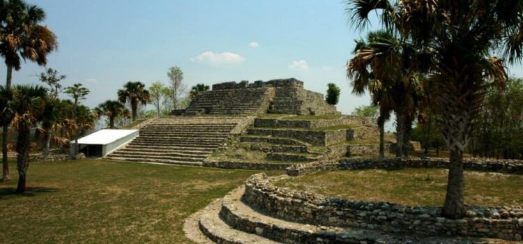
Zona arqueológica Balamkú
The balamku is preserved a stucco frieze modeled AND painted, unique in the Mayan area that was elaborated at the beginning of our era. In the frieze four scenes of ascent alternate with jaguars are appreciated. Each one comprises an animal with the head turned back, seated in the frontal cleft of a face of the monster of the earth, on his mouth there is a king on his throne. In addition to illustrating in detail the O OR complementary aspects of the underworld, the whole shows that the dynastic cycle equates to the solar cycle. In this conception, Ascension to the throne is illustrated by the king coming out of the mouth of the earth; The death of the king is seen as a sunset, When it falls in the mouth of the terrestrial monster
If you would like to know everything about Balamkú and its relation with Calakmul and the other archaeological zones we recommend to hire the service of a specialized guide in the subject.
- Balamkú is located 3 km from the town of Conhuás, 55 km from Xpuhil.
- Sundays are free for the national and residents with official identification.
- Cost of entry: 47 MXN.
- How to get there by public transport? To Conhuás public transport arrives from Escárcega (2 hours) and from Xpuhil (30 minutes). From Conhuás you must walk about 2 kilometers to the entrance.
- It is recommended to wear light and light clothing, hat, insect repellent, sunscreen, closed shoes and some water is always good.
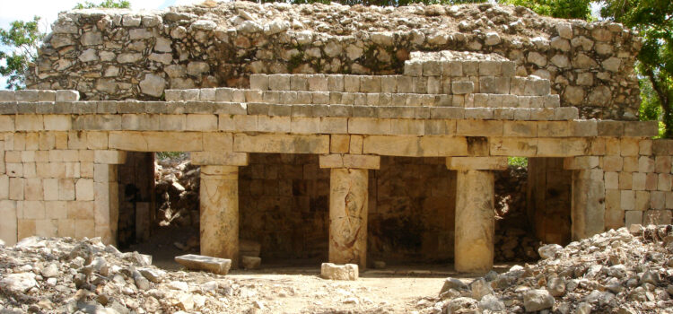
Zona arqueológica Chicanná
This old pre-Hispanic settlement is one of the 16 currently open to the public of the State of Campeche. Its oldest occupation is located near the beginning of our era during the late preclassic period (300 BC to 250 AD), although its peak dates from the late classic (550 to 700 AD) when carried out Its last monumental constructions
If you would like to know everything about Chicanná and its relationship with Calakmul and the other archaeological zones we recommend you hire the service of a specialized guide on the subject.
- Chicanná is located at kilometer 141 of Federal Highway No. 186, Escárcega-Chetumal, 2 kilometers from the highway.
- Sundays are free for the national and residents with official identification.
- Cost of entry: 47 MXN.
- They do not sell drinks or food inside. There are services at the entrance.
- How to get there by public transport? To Xpuhil there is public transportation from Escárcega (2 hours), Chetumal (1 hour 40 minutes) and Campeche (4 hours 30 minutes).
- It is recommended to wear light and light clothes, hat, insect repellent, sunscreen, closed shoes better and some water is always going well.
Zona arqueológica Xcalumkín
The pre-Columbian vestiges of Xcalumkin cover an area of 10 km ² And they are important by the monumental architecture And by the great amount of hieroglyphic inscriptions associated. In some texts of the site the glyph emblem of jaina has been registered, Coastal city that distutes about 50 km And with which Xcalumkin maintained close relation, Especially in century VIII.
If you would like to know everything about Xcalumkín we recommend to hire the service of a specialized guide in the subject.
- Sundays are free for the national and residents with official identification.
- Cost of entry: 47 MXN.
- They do not sell drinks or food inside.
- It is recommended to wear light and light clothes, hat, insect repellent, sunscreen, closed shoes better and some water is always going well.
Zona arqueológica El tigre
The archaeological zone takes its name from the adjacent ejido, in fact the tigers are of the old world but popularly it is called to empty Jaguar. In ancient times it was called itzamkanac “Seat of the lizard / snake” possibly alluding to the seat of the deity itzamna
The monumentality of the constructions And the extension of the zone indicate that it was the capital of the acalanes And perhaps the place where Hernán Cortés killed Cuauhtémoc.
It sits on a hill next to the Candelaria river. It has a long occupation sequence ranging from the preclassic middle 600 to 300 a. C. Until the protohistórico 1557 d. C. is conformed by six architectonic groups; The central aria includes peteneros buildings in the sub structures. Also elements of architecture Bec Bec And others of late times.
If you would like to know everything about The Tiger we recommend you hire the service of a guide specialized in the subject.
- Sundays are free for the national and residents with official identification.
- Cost of entry: 47 MXN.
- They do not sell drinks or food inside.
- It is recommended to wear light and light clothes, hat, insect repellent, sunscreen, closed shoes better and some water is always going well.
Caleta de Yal-kú
The cove of Yal-kú, located in the coastal town of Akumal, we find one of those Caribbean corners with which you will surely surprise you on your way. At this outlet from the sweet waters underground to the open sea, you will enjoy a unique landscape.
- Yal-kú is located in Akumal, 3 km from the entrance to the beach. Akumal is located 37 km from Playa del Carmen and 26 from Tulum.
- Sundays are the busiest day.
- Cost entrance: 200 pesos adults, children 130. Discount for local Quintana Roo, take your identification.
- Services: showers, lockers, bathrooms, rental of snorkel equipment, palapas and restaurant. There is parking. It is not allowed to use non-biodegradable body creams, nor to feed the fish. I’ll pick you up to bring your own snorkel gear.
- How to get there by public transport? From Tulum, buses leave on the main street. From Cancun (buses leave near the ADO terminal) you have to get off at the last stop in Playa del Carmen and from here take another bus to Akumal (from street 2 between 15 and 20 avenue). Public transportation leaves you on Federal Highway 307, on the bridge at the entrance of the village (warns the driver, he knows). From here you walk 1 km to the beach. The ADO (big bus) does not stop in Akumal, you must go by combi, bus, van, van … There is taxi service in Akumal to Yal-ku. At the exit of the cove, they will call you a taxi if you need it.