
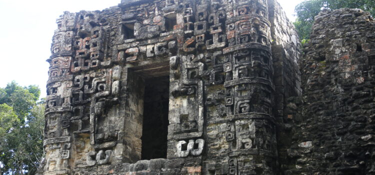
Balamkú – Impressive frieze in Calakmul Mayan civilization
The frieze is the most relevant monument made of stucco modeled and polychrome, with a height of 1.75 m. And a length of 16.80 m, elaborated between the years 550 and 650. The scene represents an allegory of the order of the universe with figures of serpents and jaguars. Iconographic richness, reading to detail reveals the complex conceptual world of the ancient Maya. The dynastic cycle is equated with the solar cycle. In this conception, the ascension to the throne is illustrated by the king coming out of the jaws of the terrestrial monster, as the sun comes out of the mouth of the Earth. The king’s death is seen as a sunset, when it falls into the mouth of the Earth Monster.
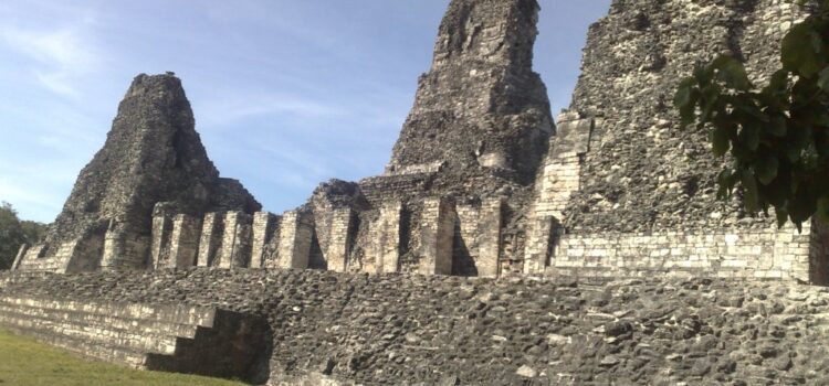
Hormiguero Impressive main structure in Calakmul Mayan civilization.
Hormiguero takes its name from a chiclero camp that existed near the archaeological vestiges in the decade of the 30, of the last century, when Karl Ruppert and John Denison toured the region.
Hormiguero was reported by Karl Ruppert and John Dennison during his second expedition to Campeche, sent by the Carnegie Institution of Washington in April 1933. However, it was not until 1979 that the first conservation and excavation work was undertaken. Today we know that the period of greatest occupation of the site has been recorded, according to the archaeological evidence, between the years 600 and 800 of our era, within the period known as Late Classic. Its main architectural feature is a building whose facade is divided into three, leaving to the center a large masquerade flanked by towers of rounded corners with simulated staircases typical of this region. The mask presents, as an entrance to the temple, a monstrous mouth opening its jaws, a concept that is interpreted as a threshold between the outside world and the underworld.
Hormiguero structure 2 in Calakmul Mayan civilization.
Hormiguero takes its name from a chiclero camp that existed near the archaeological vestiges in the decade of the 30, of the last century, when Karl Ruppert and John Denison toured the region.
Hormiguero was reported by Karl Ruppert and John Dennison during his second expedition to Campeche, sent by the Carnegie Institution of Washington in April 1933. However, it was not until 1979 that the first conservation and excavation work was undertaken. Today we know that the period of greatest occupation of the site has been recorded, according to the archaeological evidence, between the years 600 and 800 of our era, within the period known as Late Classic. Its main architectural feature is a building whose facade is divided into three, leaving to the center a large masquerade flanked by towers of rounded corners with simulated staircases typical of this region. The mask presents, as an entrance to the temple, a monstrous mouth opening its jaws, a concept that is interpreted as a threshold between the outside world and the underworld.
Becan – Ascent to Pyramid Greater 32 m in Calakmul Mayan Civilization
The existence of a moat that surrounds the nuclear area of Becán determined its name, which in Yucatecan Mayan means “Path or cavity left by the running of the water”, name that refers to the most remarkable feature of the site: a moat that surrounds the main Architectural ensembles comprised by the largest and highest buildings of the site.
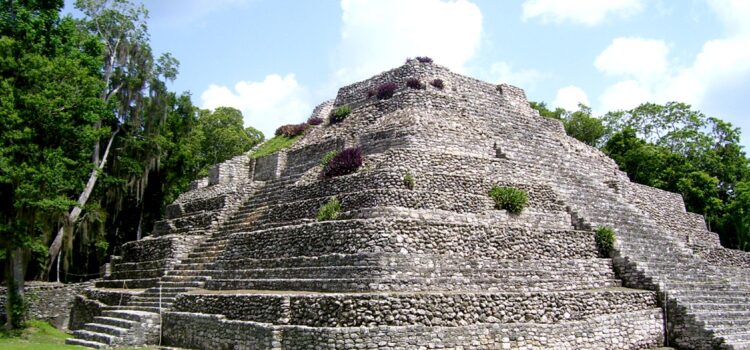
Chacchobén
Chacchobén is a Mayan archaeological site located near the homonymous town of Chacchobén, to 70 km. Of the Mexican city of Chetumal. Its name alludes to “red corn”. The site corresponds to the largest settlement to date reported in the area known as the Lakes Region.
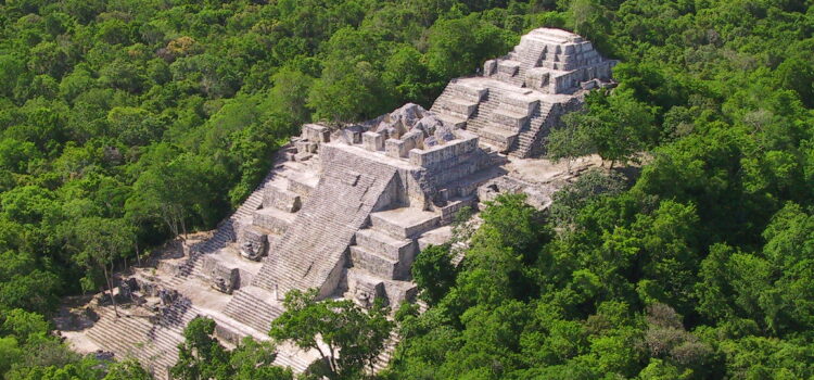
Archeological site Calakmul
It was one of the largest important cities in the region. It establishes a matchless socio-political network of links. After the year 695 AD. C. Due to his defeat at the hands of Tikal he had a political reorientation towards the north,
It was one of the largest major cities in the region. It establishes an unparalleled sociopolitical network. After the year 695 d. C. Due to its defeat at the hands of Tikal it had a political reorientation toward the north, where the new rulers established relations with other sites of the area known as River Bec. In spite of the diminution of its political power, the city experienced urban growth, since most of the vestiges that today are observed correspond to this period.
Calakmul is the most important area of Campeche, if you would like to know everything about the enigma that surrounds Calakmul we recommend hiring the service of a specialized guide.
- There are two payments, access to the archaeological zone of 70 MXN and to the Calakmul Biosphere Reserve, which you pay per vehicle MXN 56 and MXN 50 per person.
- The access entrance to the Biosphere Reserve, which is in Conhuás, open at 6 in the morning. Sundays are free for the national and residents with official identification.
- They do not sell drinks or food inside. There are services at the entrance.
- There is no public transport until the archaeological zone. The options are taxi, agency or private vehicle. To Xpuhil there is public transportation from Escárcega (2 hours), Chetumal (1 hour 40 minutes) and Campeche (4 hours 30 minutes). Conhuas arrives collectively from Xpuhil.
- It is recommended to bring light and light clothing, hat, insect repellent, sunscreen, closed shoes (you are in the jungle and there are many bugs, protect yourself), water and something to eat if ideas spend the whole day.
Zona arqueologica Becán
Discover the “snake path”
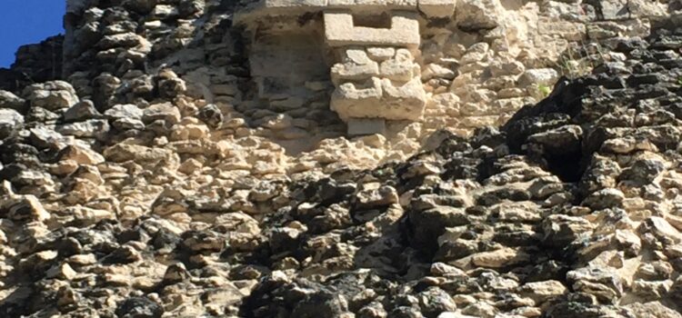
It is located in the middle of the base of the Yucatecan peninsula, in the south of Campeche and the archaeological region of Rio Bec. The architecture is characterized by palaces of several rooms wide interior benches, with tall towers and narrow all sides. The towers have impractical stairs and false temples at the top; Symbolize sacred mountains. The facades usually show large zoomorphic masks or squared panels and symbolic vegetal motifs or waterfalls of stylized masks.
If you would like to know everything about Becán and its relation with Calakmul and the other archaeological zones we recommend to hire the service of a guide specialized in the subject.
- Becán is located 8 km from here of the town of Xpuhil, on the 186 Chetumal-Escárcega Federal Highway.
- Sundays are free for the national and residents with official identification.
- Entry fee 47 MXN.
- They do not sell drinks or food inside. There are services at the entrance.
- How to get there by public transport? To Xpuhil there is public transportation from Escárcega (2 hours), Chetumal (1 hour 40 minutes) and Campeche (4 hours 30 minutes).
- Wear light and light clothing, hat, insect repellent, sunscreen, closed shoes better to climb the pyramids and some water is always going well.
Zona arqueologica Xpujil
The enigmatic “cat tail”
The area of the pre-Hispanic site of Xpuhil that is open to the public and in the custody of INAH is only an architectural group known as group one which is constituted by some of the many buildings that are part of the archaeological zone. In fact, to date has been reported about 25 architectural groups on a total area of land comprises an area of about 24 km ². As the current population of Xpuhil, head of the municipality of Calakmul, is located in the same place as many of the ancient pre-Columbian Maya community, it is evident that many mounds are affected on the surface of the site.
If you would like to know everything about Xpujil and its relation with Calakmul and the other archaeological zones we recommend to hire the service of a specialized guide in the subject.
- Xpuhil is located a few meters from the town of Xpuhil, on Federal Highway 186, at the exit west direction Escárcega.
- Sundays are free for the national and residents with official identification.
- Cost of entry: 47 MXN.
- They do not sell drinks or food inside. There are services at the entrance.
- How to get there by public transport? To Xpuhil there is public transportation from Escárcega (2 hours), Chetumal (1 hour 40 minutes) and Campeche (4 hours 30 minutes).
- It is recommended Light and light clothing, hat, insect repellent, sunscreen, closed shoes better and some water is always going well.
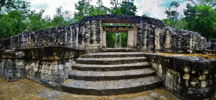
Zona arqueológica Hormiguero
Nestled in the heart of the southern jungle of the state of Campeche, the anteater site is made up of about a hundred pre-Hispanic structures. It was registered in 1933 and was named after the large number of “ant houses” found. Three large architectural groups are defined, of which, The so-called center has been the area where archaeological interventions have been carried out since the decade of the 70’s of last century.
If you would like to know everything about anthill and its relationship with Calakmul and the other archaeological zones we recommend to hire the service of a guide specialized in the subject.
- Hormiguero is located 23 kilometers from Xpuhil, 7 kilometers south of the ejido Echeverría Castellot. Xpuhil is on the southern cerretera that links Chetumal with Escárcega.
- Free entry. There are services at the entrance.
- How to get there by public transport? To Xpuhil there is public transportation from Escárcega (2 hours), Chetumal (1 hour 40 minutes) and Campeche (4 hours 30 minutes). From Xpuhil you can take public transport to Echevarría Castellot and from here walk 8 kilometers or go by taxi.
- We recommend wearing light and light clothing, hat, insect repellent, sunscreen, closed shoes and some water is always good.
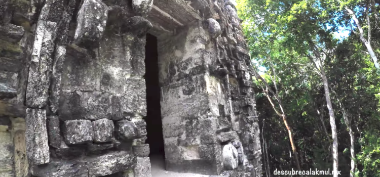
Zona arqueológica Balamkú
The balamku is preserved a stucco frieze modeled AND painted, unique in the Mayan area that was elaborated at the beginning of our era. In the frieze four scenes of ascent alternate with jaguars are appreciated. Each one comprises an animal with the head turned back, seated in the frontal cleft of a face of the monster of the earth, on his mouth there is a king on his throne. In addition to illustrating in detail the O OR complementary aspects of the underworld, the whole shows that the dynastic cycle equates to the solar cycle. In this conception, Ascension to the throne is illustrated by the king coming out of the mouth of the earth; The death of the king is seen as a sunset, When it falls in the mouth of the terrestrial monster
If you would like to know everything about Balamkú and its relation with Calakmul and the other archaeological zones we recommend to hire the service of a specialized guide in the subject.
- Balamkú is located 3 km from the town of Conhuás, 55 km from Xpuhil.
- Sundays are free for the national and residents with official identification.
- Cost of entry: 47 MXN.
- How to get there by public transport? To Conhuás public transport arrives from Escárcega (2 hours) and from Xpuhil (30 minutes). From Conhuás you must walk about 2 kilometers to the entrance.
- It is recommended to wear light and light clothing, hat, insect repellent, sunscreen, closed shoes and some water is always good.